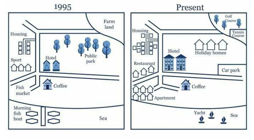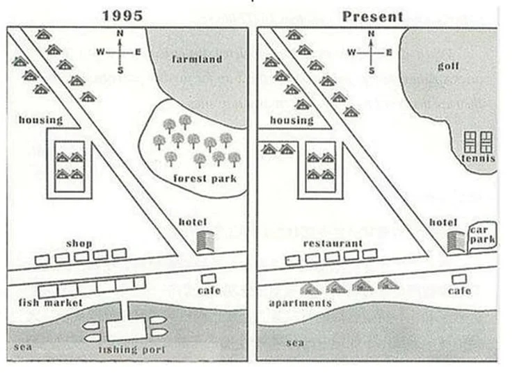
The maps compare the layout of a coastal city in 1950 with its present configuration. The changes indicate a clear transformation from a small, locally focused settlement into a tourism-oriented urban area, with natural and productive land yielding to denser housing, leisure facilities, and expanded services.
In the early period, low-intensity land uses predominated in much of the city's northern and eastern areas. Farmland occupied the northeastern corner, while a public park was located centrally. Fishing-related facilities, including a fish market and fishing boats, were also concentrated along the southern coastline. In the present layout, these features have largely disappeared. The farmland in the north-east has been replaced by a golf course and tennis courts, while the former parkland at the center has been redeveloped into an expanded hotel complex and holiday homes. Similarly, fishing activities have been replaced by yacht facilities, signaling a shift toward recreational use of the coastline.
Meanwhile, the western and south-western parts of the city have become more built-up and functionally diverse. The older housing increased in size, and residential zones have expanded to include apartment blocks in the south-west, and new commercial amenities—such as restaurants and a car park—have been added nearby. All of these areas are better interconnected by a more extensive road network.